|
Article Review by Christy Bryar
Revealing the Landscape Qualities: Landscape plan for Drentsche Aa River, NetherlandsStrootman Landscape Architects, Topos European Landscape Magazine no.66, 2009
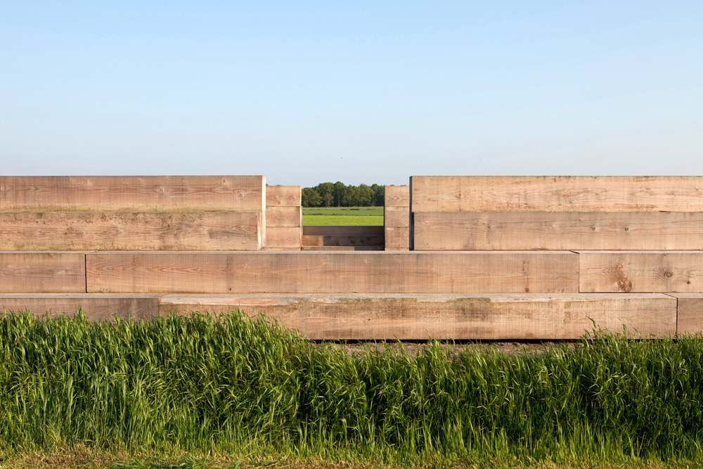
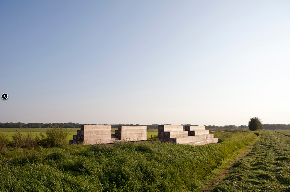
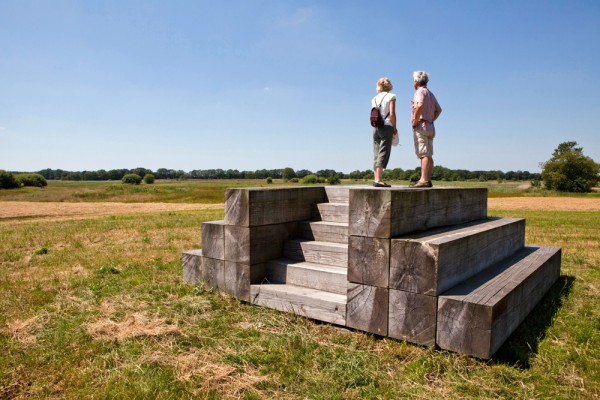
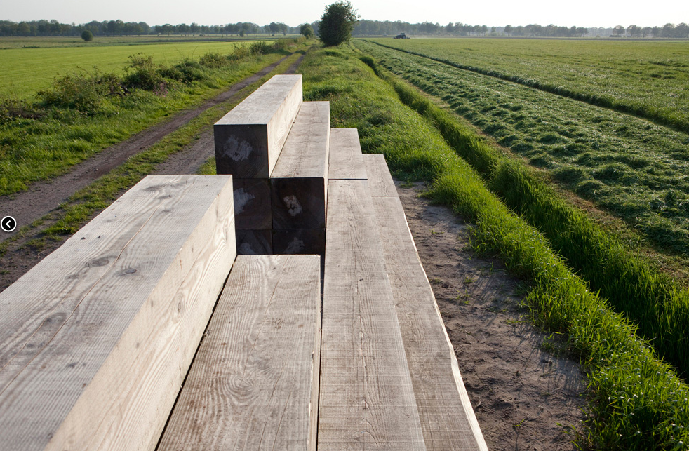
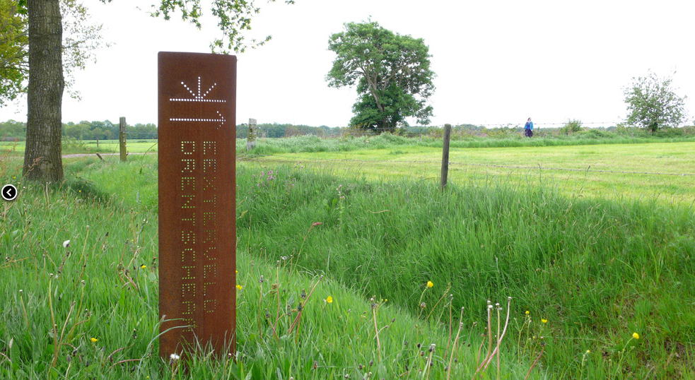
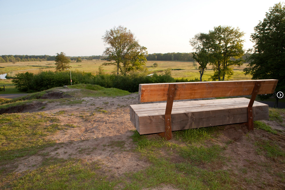
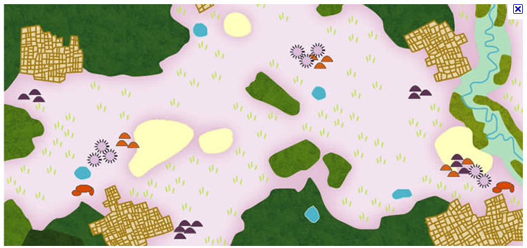
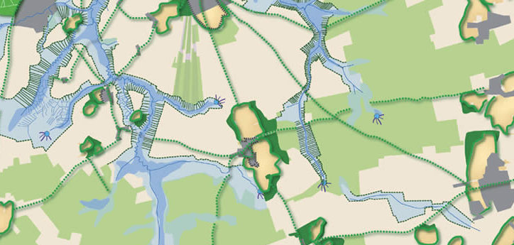
The Drentsche Aa is a river in the Dutch province of Drenthe which has a rich archaeological history dating back some 6000 years. The landscape has largely escaped being consolidated into housing to date and a significant part of the area has been declared a national park. However like many greenfield areas, the Drentsche Aa valley environment is at risk from the impacts of urban sprawl and community indifference. Strootman Landscape Architects have developed and began implementing a landscape plan for the area. Their approach has been to make a number of interventions across different scales to accentuate the landscape and improve the legibility of historical elements. They use this as a device for dramatising the landscape and telling its story and to encourage contemplation about it. By highlighting the environmental and cultural history of the landscape they aim to increase its perceived value and therefore increase its protection. Strootman have identified 30 locations based on contours, archaeological sites, historical routes and points of interest to intervene and enhance the landscape. The design interventions mainly consist of the removal of shrubs and trees to create views in combination with the creation of a place where one can enjoy the landscape from and architectural markers strategically placed along historical routes. The built outcome draws from a historical tradition of Belvederes, an open structure for enjoying the landscape that has been used in the Dutch landscape for centuries. Each location highlights a particular set of relationships in the landscape viewed from the new belvedere. For example, at the Looner Esch the new belvedere provides a view between the megalith and a small peatbog situated further along, the two of which have an important historical relationships. A consistent design language is employed through materiality of timber and corten steel and the form of the belvederes to create linkages between the sites Approach Strootman’s approach to sustainability is to facilitate enjoyment and provoke inquiry through minimal intervention, as a means of raising awareness and increasing the perceived value of the landscape. Placing a higher value on landscape increases the likelihood of people taking care for it and advocating for its protection. Their landscape plan for the area restores the original character of the landscape by removing trees and improving waterways, yet also aims to be robust enough to handle the inclusion of new development and intervention. Scale The scale addressed is localised to each point of interest in the park and then unified through design language. It uses a small scale approach to interpret a larger and sometimes invisible aspect of landscape, that is its history. The interventions are part of a wider landscape plan of improving the waterways and natural systems of the 30,000ha site. Program A consistent design language has been created across each location for the furnishings, signboards, parking facilities and brand marks. Each location will have a belvedere in the form of a seat to frame a set of relationships and from which to enjoy the landscape. The interventions allow the visitor to slow down and stop to develop a deeper connection to the landscape and its history. How The technologies used are passive and simple for the interventions. A place to sit, a branding advising exactly where you are and signage to guide you to the next location. The idea allows for quiet contemplation by the visitor, encouraging them to understand and interpret what they are seeing. Likewise by densfying the edges of the stream valleys with forest and clearing the centres the open space become dominant and accentuated. Challenges and Opportunities The challenge with such a project is how to reach a broad audience than those who would already advocate for the environment and already engage in activities in National parks and have a strong connection to nature. An opportunity might exist to bring some of the design language and built forms into the surrounding villages connecting them to the landscape beyond. Image References 1 -4. Belvederes in Dretsche AA framing the landsacpe. Source: Landzine, 2010, Belvederes Drentsche Aa 5.Signage in Dretsche AA. Source: Landzine, 2010, Belvederes Drentsche Aa by Strootman, http://www.landezine.com/index.php/2010/11/belvederes-drentsche-aa-by-strootman/ 6. Belvedere in Dretsche AA. Source: Landzine, 2010, Belvederes Drentsche Aa by Strootman, http://www.landezine.com/index.php/2010/11/belvederes-drentsche-aa-by-strootman/ 7. Map showing mound, open areas and densified edges. Source: Bern Strootman, Strootman Landscape Architects, viewed September 2011, http://www.strootman.net/site/eng/ 8. Map of regional area of site, showing the structure of plots and open landscape. Source: Bern Strootman, Strootman Landscape Architects, viewed September 2011, http://www.strootman.net/site/eng/ 9. Sketch illustrating the densifcation at the edges of the valley. Source: New Italian Blood Interactive Magazine, 2000-2010, viewed September 2011, http://www.newitalianblood.com/index.pl?pos=01.00&item=6020&lang=en |
